Spatial technology continues to change the face of asset management. At a recent conference, Duratec’s digital asset lead Jane Hogben spoke on the technology’s proven and potential uses.
When it comes to buildings and infrastructure, asset management goes far beyond just maintenance. Best-practice asset management solutions allow owners to understand, improve and realise maximum value from their portfolios. Spatial technology only enhances these solutions.
At the Asset Management Council’s recent AMPEAK conference in Adelaide, Duratec’s digital asset lead Jane Hogben presented a paper titled Using spatial technology to navigate asset management for geographically dispersed portfolios. The paper addressed both the proven and potential uses of spatial technology to facilitate asset management practices, and looked at how “the use of collaborative, trusted, current and accessible information portals enable data-driven decision-making across the landscape of asset interactions – from the board room to the crib room”.
The paper contains technical insight into the current and future role of spatial technology within the asset management field. InSpec has summarised some of the key takeaways below.
Geographic challenges facing asset management
Asset-owner organisations seeking to implement an asset management system face a variety of challenges, including those of a geographic nature, i.e. remoteness and lack of accessibility. Companies operating across Western Australia are a good example.
If Western Australia were a country, it would be the 10th largest in the world. More than 90 per cent of the population is concentrated into the south-west of the state where many asset-intensive organisations, such as mining, oil and gas, and transport companies, have headquarters, despite being operational exclusively in the north and/or offshore.
The difficulties facing organisations looking to monitor and maintain their geographically dispersed assets, therefore, speak for themselves, and this geographic challenge is by no means unique to WA.
Enter spatial technology
Spatial technology refers to any digital solution that uses a real-world position of data. Location is more intuitive and ‘human-readable’ than alpha-numeric codes when it comes to multiple fixed data sets. An asset’s location, defined by a unique global coordinate, provides a single reference point against which to relate other assets, people and services, as well as contextual data, such as environmental, geographic, demographic, logistical and weather. It makes spatial technology the ideal ‘plug-in’ for asset management systems.
The benefits of spatial technology within asset management systems
Spatial technology meets asset information goals by:
- Allowing users to better understand assets and make decisions in context
- Making asset information findable and accessible
- Enabling transparent, auditable, data-driven decision-making
- Capturing subject-matter expert (SME) knowledge
- Reducing remediation cost and risk by scoping accurately and managing works efficiently
- Tracking condition over time
A focus on GIS
GIS (geographic information systems) is an example of spatial technology. As an asset information interface, it allows asset owners to overcome geographical challenges as it:
- Is visually based
- Is underpinned by standardised coordinate reference systems
- Enables multi-modal data and systems integration
- Enables multi-modal relationships and analytics
- Facilitates collaboration and dissemination of information
GIS and asset management
GIS has been used for effective asset management in the utilities space for decades. Water, electricity and gas distribution networks are adequately represented two-dimensionally (2D), as are other linear assets, such as road and rail networks.
With the advent of 3D GIS, the ability to visualise, integrate, analyse and disseminate asset information about geometrically complex or vertical structures is also being realised. Deploying GIS to a digital asset management system can improve key asset information principles, such as quality, accessibility and usability.
The proof is in the pudding
GIS assists in the realisation of asset management practices, such as reducing inefficiency in the form of rework or time spent searching for information. Below is just one example.
Case study: COVID-restricted site access no barrier for mining company
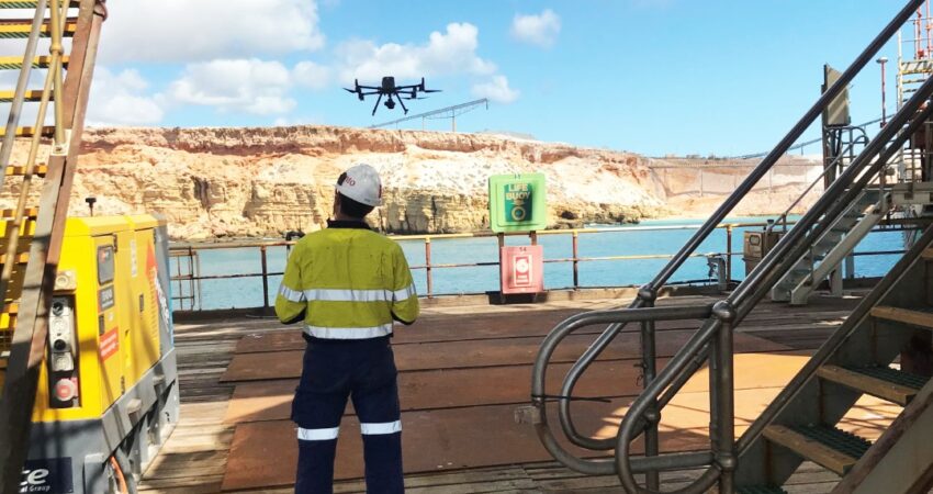
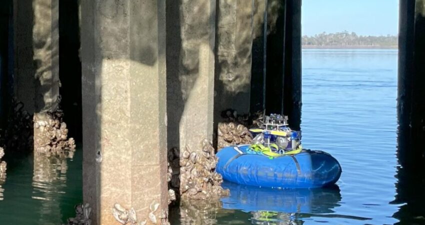
During the COVID-19 pandemic, a mining company was seeking to carry out inspections of its wharf in the North West of WA. Its engineers, however, were unable to enter the state to visually inspect the assets. Instead, Duratec was engaged to carry out inspections digitally and remotely, before retrieving and documenting the data.
Capturing the data
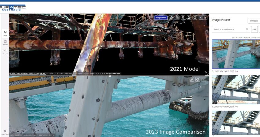
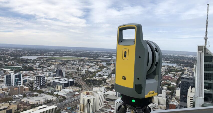
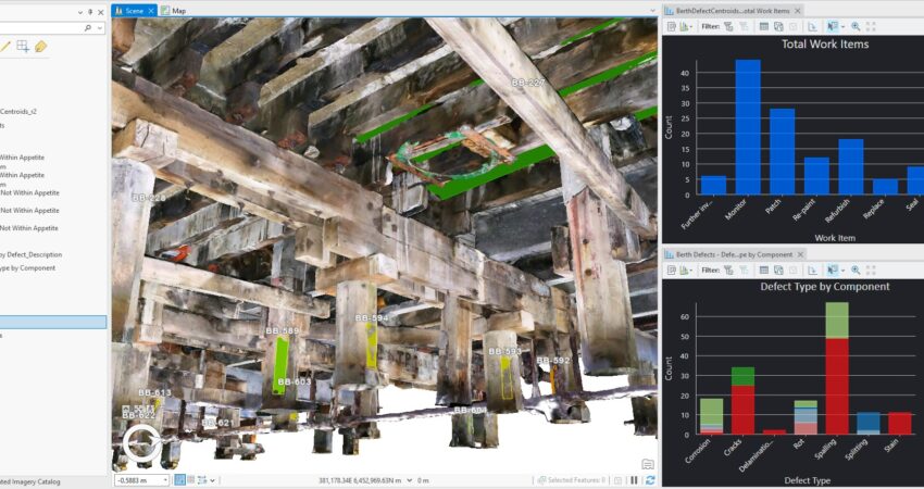
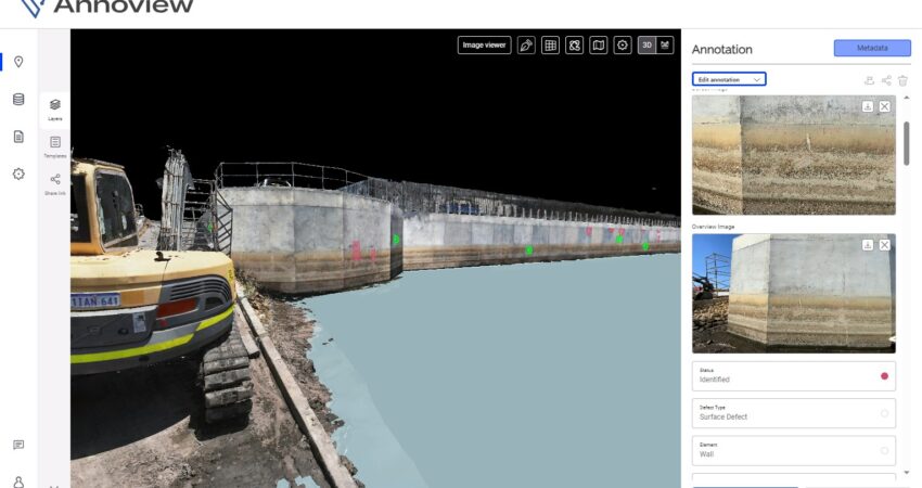
Reality-capture, combining laser-scanning and high-resolution photogrammetry, was conducted by the Duratec team over a two-week period, which reduced the time required on site. The reality model and still photography were delivered in a 3D GIS environment, overlaid with asset identification numbers, allowing defects to have both a linking identifier to the asset hierarchy and a real-world spatial coordinate enabling location on site.
A collaborative cloud environment
Detailed defect information, images and diagrams were documented digitally in a collaborative cloud environment where Duratec, the client and the spatial support organisation could collaborate in real-time. This environment allowed ongoing quality control and quality assurance throughout the inspection, and saved time usually spent on document review and amendments.
Scoping remediation works
The client used the same GIS environment to create work packages and provide tenderers with access to the defect data and 3D modelling. The amount of reporting and documentation work that was reduced during this phase (due to using GIS tools, such as data aggregation and summarising, spatial relationship packaging and prioritisation) amounted to between 12 and 18 months, according to the client.
Improving estimate accuracy
The GIS asset data allowed remediation tenderers to accurately estimate costs for materials, works and access across the site without their physical attendance. Duratec was fortunate enough to be awarded the works and continues to plan, execute and track progress in the same digital environment, providing transparency and oversight to the client.
Short and long-term benefits
Estimated cost savings run into the millions over the stages of this exercise. In the future, the client could potentially undertake asset management activities on these structures with a comprehensive log of remaining defects, plus a high-definition visualisation of the assets.
On the horizon
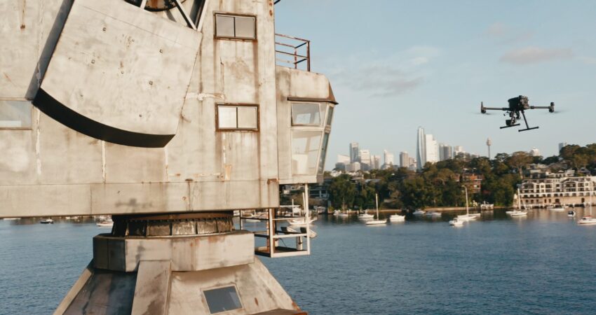
The advances in spatial technology are just the beginning of a rapid evolution of the digitisation of physical assets. Computer vision can now intelligently recognise and extract features over large areas from orthomosaic and oblique photography.
Duratec’s spatial data specialists are currently working to do this in 3D, focusing specifically on intelligent defect detection. This capability would see a huge cost reduction for regular remote asset inspections and could also increase efficiencies during remediation and ongoing monitoring.
It is envisaged that in the not-too-distant future, drones may be able survey structures and collect data only where they detect significant changes to condition. Biomimetic design, which refers to the study and application of natural processes to remediate built assets, could lead to self-cleaning or self-repairing structures.
One thing is for sure, the fast-evolving field of spatial technology is likely to branch out beyond the traditional mapping and measurement fields, and continue to integrate data and facilitate design, analysis and management of assets within the context of their environment.
About the author
Jane Hogben
Digital Assets Lead, Duratec
Jane Hogben has more than 20 years’ experience in the geospatial data management and analytics space for a range of disciplines including environmental, engineering and asset management. She currently leads Duratec’s reality-data delivery program, helping clients gain maximum value from asset digitisation.
Jane works across Duratec’s divisions to implement digital defect mapping, particularly for dilapidation surveys, QA/QC and client handover.
For assistance or ideas, email [email protected].

